


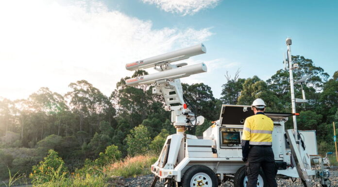
Orica Digital Solutions’ GroundProbe radar platform is a fully integrated monitoring solution, combining next‑gen hardware, software and modern workflows for better reliability, faster insights and safer operations. (Photo: Orica)
Iterative modeling and multi-sensor monitoring, combined with expert data analysis, allow engineers to assess complex slope behavior and manage uncertainty in deeper open-pit mines
By Nia Kajastie, European Editor
Many surface operations are trending towards steeper and broader pits as mining extends into deeper parts of orebodies. This increases slope heights and the uncertainty around their stability.
Slope behavior is influenced by various interrelated factors, including geological and groundwater conditions, structural controls and stress redistribution, as well as the mining activities and sequence themselves.
To help reduce some of the uncertainty, “a huge effort is directed toward bridging the gap between predictive models and actual slope behavior in the field,” noted Lorenzo Leoni, director of the mining business at IDS GeoRadar, part of Hexagon.
As a result, modern geotechnical models are becoming more sophisticated.
“However, large open-pit slopes and tailings storage facilities remain highly heterogeneous systems, and their behavior is often influenced by factors that are difficult to characterize with complete certainty,” Leoni said.
“From a modeling perspective, uncertainty in geological structures, rock mass properties, groundwater conditions and changing mining geometries can significantly influence predicted stability. Even the most advanced numerical models are ultimately based on assumptions that need continuous validation against real-world observations.”
Monitoring technology and the data it produces are no longer on the periphery of risk management, as they support operational safety and production continuity.
Today’s mines are also producing ever larger volumes of geotechnical, hydrogeological and operational data, which needs to be efficiently managed and analyzed. The data comes from slope monitoring radars, terrestrial light detection and ranging (LiDAR) systems, prisms, global navigation satellite system (GNSS) stations, satellite interferometric synthetic aperture radar (InSAR), piezometers, weather stations and other sensors.
The challenges around slope stability are therefore not about a lack of information, but rather how best to turn the data into actionable geotechnical intelligence.
“Engineers need to distinguish between normal deformation, operationally induced movements and deformation patterns that may indicate an evolving instability,” Leoni explained.
Harold Forsyth, vice president of remote monitoring at Orica Digital Solutions, pointed out that understanding how all the different factors influencing slope stability are connected requires more than any single monitoring technology can provide.
“We’re seeing a growing need for integrated monitoring ecosystems that bring together multiple data sources into a single view of asset behavior. The challenge for operators is moving beyond monitoring individual datasets to developing a comprehensive understanding of risk that supports timely and informed decision-making,” he said.
The monitoring data should also be integrated with geotechnical models. As Leoni noted, the industry has historically often treated modeling and monitoring as separate activities, but it is now moving towards a more joined-up approach.
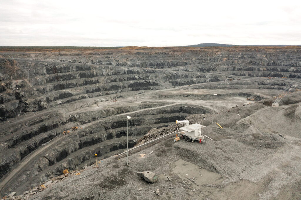
The ArcSAR Neo 3D ground-based synthetic aperture radar for 360° mine slope monitoring. (Photo: IDS GeoRadar/Hexagon)
“Geological, geotechnical and hydrogeological information should be incorporated into the design process from the outset to establish a robust understanding of the conditions likely to influence slope performance throughout the mine life,” said David Armstrong, vice president of in-situ monitoring at Orica Digital Solutions.
Additionally, geotechnical and hydrogeological models should not be seen as static design documents, but as something “living” that evolves throughout the life of a mine.
“The greatest value is achieved when monitoring data continuously informs and calibrates geotechnical models, creating a feedback loop that improves both risk assessment and forecasting capabilities,” Leoni said.
These trends are linked to the idea of the fully digital mine. In a recent white paper, Thomas Gaisecker, business division manager for mining and monitoring at RIEGL International, wrote that this concept “describes an operating environment in which decisions are based on connected sensors, automated workflows and data that can be evaluated without delay.”
With monitoring becoming a continuous, near-real-time source of information for planners, geotechnical teams and operational managers, according to Gaisecker, this also raises expectations.
“Mines need monitoring data that is precise, reliable, spatially dense and available fast enough to support action,” he said.
Forsyth stressed that Orica’s mining clients ultimately want to have “greater confidence in managing slope performance.”
“That confidence comes from combining technology, data and expertise to transform monitoring information into actionable insights that support safer and more productive operations,” he continued.
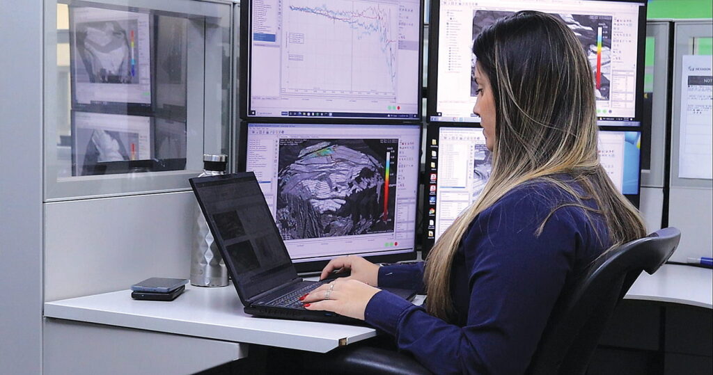
One of Hexagon’s 24/7 remote mine monitoring centers in Brazil. (Photo: Hexagon)
Complementary Technologies
Within slope stability monitoring, Hexagon’s Leoni believes one of the most impactful developments in recent years has been the evolution of radar from a measurement tool into a comprehensive decision-support technology.
“Modern radar systems, such as the latest generation ArcSAR Neo solutions, deliver continuous, high-resolution monitoring over large areas with increasing deployment flexibility and operational efficiency,” he explained. “This allows geotechnical teams to detect subtle deformation patterns earlier, monitor complex slope movements and maintain continuous situational awareness across entire pit walls or tailings facilities.”
Orica’s Forsyth, who represents the GroundProbe and 3vGeomatics product ranges, has a similar view. He highlighted the GroundProbe SSR-XT ground-based radar as a valuable tool for detecting surface deformation and providing early warning of changing conditions.
The satellite-based 3vGeomatics InSAR, in turn, can add another dimension; it can identify long-term and large-area deformation patterns that may not be visible through site-based monitoring alone, Forsyth explained.
Mining operations also use in-place instrumentation to understand the factors driving movement in slopes. Technologies such as RST Instruments’ piezometers, extensometers and Measurand ShapeArray can help measure groundwater pressures and subsurface deformation. This helps provide context that surface monitoring alone cannot deliver.
In the recent RIEGL white paper, Gaisecker noted that many mining-related deformation processes are spatially complex.
“They develop across surfaces, through zones and over time in ways that cannot always be captured sufficiently by single point data (total station) or spatial low resolution 2D line-of-sight information (radar) alone,” he said.
In his view, the most robust monitoring strategies therefore combine complementary technologies rather than treating them as competitors.
“Total stations provide precise control at selected points, radar contributes high sensitivity to line-of-sight movement and LiDAR adds dense three-dimensional geometry,” he continued. “The added value of LiDAR is especially strong where the spatial extent, volume and shape of a deformation zone are as important as the displacement magnitude itself.”
Orica’s Armstrong, who represents Syscom Instruments, RST Instruments, Measurand and NavStar, made a similar point, arguing that “the limitation of any technology is that it only captures part of the overall picture. While monitoring systems have become extremely effective at detecting change, understanding why that change is occurring still requires interpretation, experience and multiple sources of information.”
On the data processing and analysis side, there have been advances in software capabilities. However, as these systems become more sensitive and generate more data, engineers want to have full confidence in their data.
“Sophisticated processing algorithms, automated quality controls, intelligent alarming and advanced visualization tools are essential to distinguish meaningful geotechnical trends from environmental or operational noise,” Leoni said.
Failure Prediction
It is clear that the industry has witnessed advances in monitoring technology and modeling; however, predicting slope failures in ever deeper and steeper open pits is a difficult task.
“While modern numerical models are becoming more sophisticated, they are still simplifications of reality and depend on assumptions that may change as mining progresses,” Leoni reiterated.
“On the monitoring side, technologies such as slope monitoring radar have dramatically improved our ability to detect and track deformation. Today, we can identify subtle movements earlier than ever before and monitor entire slope sectors continuously.
“However, monitoring systems primarily tell us what is happening; understanding precisely why it is happening and how a failure mechanism will evolve still requires geotechnical interpretation.”
Failures can be preceded by complex deformation patterns rather than simple, progressive acceleration. Thus, monitoring data should be combined with advanced processing and analysis tools that can extract valuable insights from large datasets.
“The greatest opportunity for improvement lies in creating stronger connections between monitoring, modeling and operational decision-making,” said Forsyth.
The next step is then to improve the industry’s ability to explain and forecast the complex mechanisms that drive deformation.
“Artificial intelligence and advanced analytics may help geotechnical teams identify patterns and prioritize areas requiring attention, but expert judgement will remain essential,” Forsyth added.
Technology in Practice
Over the last year, Orica has focused on simplifying how geotechnical teams access, analyze and act on monitoring information.
Through the continued development of its digital solutions platforms, such as GeoExplorer and MonitorIQ, Orica said its mining clients are able to visualize and assess information from multiple monitoring systems more efficiently.
Orica has also expanded its geotechnical specialist services, providing additional monitoring, analysis and reporting support. This way site teams can supplement internal resources while maintaining greater visibility of geotechnical performance.
According to Orica, mining operations are moving toward integrated monitoring programs that combine surface deformation monitoring, in-place instrumentation and specialist analysis within a coordinated workflow.
“One example is the use of radar monitoring, satellite 3vGeomatics InSAR and geotechnical instrumentation together to monitor both surface and subsurface conditions. By combining these technologies, operators can correlate movement trends with underlying drivers such as groundwater changes or subsurface deformation, providing a more complete understanding of asset behavior,” Forsyth said.
Hexagon’s recent developments have centered on two areas: the introduction of ArcSAR Neo, which it describes as the first fully 3D ground-based SAR for 360° slope monitoring, and a new generation of advanced radar processing algorithms designed to maximize measurement quality under real mining conditions.
According to Leoni, ArcSAR Neo represents a major step forward because it captures true 3D spatial information directly at the source.
“This additional dimension significantly improves radar image focusing and helps mitigate some of the most common sources of measurement uncertainty, including multipath reflections, water-related disturbances and interference generated by moving equipment,” he explained.
An open-pit mining operation recently deployed the latest generation ArcSAR Neo technology to help provide continuous, high-resolution monitoring of critical slope sectors.
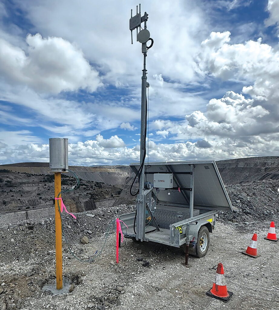
A terrestrial laser scanner operating in a mining environment. (Photo: RIEGL)
According to Hexagon, the sensitivity of the ArcSAR Neo system enabled the detection of very small deformation patterns at an earlier stage, giving the geotechnical teams more time to assess developing conditions and implement appropriate risk mitigation measures. As the system can effectively eliminate the impact of multipath reflections, it also provides cleaner and more reliable displacement data, allowing engineers to focus on genuine slope behavior rather than spending valuable time investigating potential measurement artefacts, Leoni noted.
Beyond the hardware itself, Hexagon claimed that advances in radar processing algorithms improved data quality by minimizing environmental noise.
“Combined with advanced visualization and alarming tools, this provided clearer situational awareness and more reliable support for geotechnical decision-making,” Leoni said.
“The project demonstrated that the true value of modern slope monitoring extends beyond data collection. Radar data was used not only for early warning, but also to validate engineering assumptions, refine risk assessments and support operational planning.”
Hexagon has also developed more sophisticated radar processing techniques, like those included in its Hi-Sense Atmospherics.
“We truly believe that a radar is only as good as the software that is processing and interpreting its signal,” Leoni said. “In slope monitoring, the challenge is often not to detect movement, but to distinguish real ground deformation from noise generated by atmospheric variability, changing environmental conditions and other external factors.
“As monitoring ranges increase and mines become larger and deeper, these effects can become significant and, if not properly managed, may mask subtle or very quick deformation signals.”
The technology company said it is focusing on extracting the most accurate displacement information possible from radar measurements through improved signal processing, advanced filtering techniques and enhanced data-quality algorithms.
Building on this foundation, Hexagon’s Smart Data tools can generate additional geotechnical insight from the cleaned and validated radar measurements.
“By combining radar information with complementary monitoring data, Smart Data can derive 3D deformation vectors and provide a more realistic understanding of movement direction, extent and potential failure development,” Leoni added.
RIEGL’s Gaisecker sees autonomous terrestrial LiDAR monitoring strengthening mine risk management by connecting dense 3D measurement with repeatable analysis and fast communication.
“Its role is not to replace established monitoring technologies, but to add the geometric context that point-based and line-of-sight systems cannot provide on their own,” he said.
The RIEGL sensor platform can be used for static surveying, mobile mapping and permanent autonomous monitoring, while the RIEGLMonitor+ App forms the central software environment for onboard data acquisition, alignment, epoch comparison, cluster-based change interpretation, prism monitoring, design comparison and slope-angle analysis.
Gaisecker expects monitoring systems to become more integrated into the digital backbone of mine sites.
“As mines continue to digitalize, autonomous 3D monitoring will become a key component of multi-sensor risk-management strategies: precise enough for technical interpretation, robust enough for field operation and accessible enough to support timely operational decisions,” he concluded.
The post Slope Behavior Under Scrutiny appeared first on E & MJ.